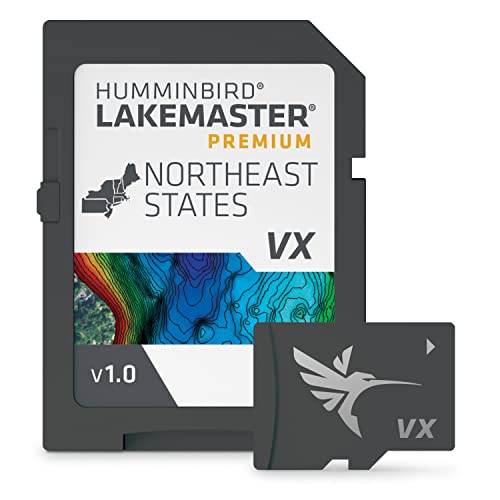
Humminbird LakeMaster Northeast V1 Map SD Card
Usually $155.13
Price checked today at 09:10 CT
Stop guessing where the fish are and start knowing.
Verified by Agora · Price and availability shown are accurate as of the date/time indicated and are subject to change. Any price information displayed at the time of purchase on Amazon will apply. As an Amazon Associate, Agora earns from qualifying purchases.
What we've verified about this price
Our read on this product
This premium map card transforms your Humminbird fish finder into a serious fishing intelligence system. It goes beyond basic depth contours by offering 2D shaded relief that really makes underwater structures pop, and aerial imagery that helps you scout from the boat before you even cast a line. The real magic for serious anglers, though, is SmartStrike, which uses data to predict where fish are likely to be biting on select lakes, and the One-Boat Network integration that lets your Minn Kota trolling motor automatically follow those depth contours for you.
It’s built for those who see fishing not just as a hobby, but as a pursuit where every detail matters. The Water Level Offset feature is a quiet but critical piece of real-world angling; it ensures the depth information you see actually matches the current water levels, which can fluctuate significantly in the Northeast. This kind of accuracy means you're not guessing about shallow water hazards or productive drop-offs.
What makes it stand out
- Provides AI-driven SmartStrike predictions to identify likely fish-biting areas, unlike basic mapping cards.
- Integrates directly with compatible Minn Kota trolling motors to automatically follow depth contours, offering hands-free boat control.
- Includes Water Level Offset to accurately display depth contours based on current water conditions, crucial for variable Northeast lakes.
- Offers 2D Shaded Relief and Aerial Imagery for superior underwater and surface visualization beyond standard map views.
When this isn't the right fit
- You primarily fish in areas not covered by the Northeast region maps.
- You use a fish finder model not listed as compatible.
- You prefer a simpler, less data-intensive mapping experience.
Real-world notes
- The ability to sync depth contours with current water levels is surprisingly useful for avoiding unexpected shallow spots.
- The aerial imagery provides a great way to scout potential fishing spots from the boat before you even drop a line.
- Following depth contours hands-free with compatible trolling motors makes positioning the boat much easier.
What you're trading off
Opened packages are not eligible for return.
Serious Northeast anglers seeking to maximize their success with integrated, intelligent mapping should consider this.
Key specs at a glance
- Feature
- 1-Year Cartography Warranty
- Feature
- 2D Shaded Relief
- Feature
- Aerial Imagery
- Feature
- Customizable Color Palettes
- Feature
- Depth Highlight
- Feature
- One-Boat Network Integration
- Material
- SD Card
How this price compares over time
Not enough tracked price history yet.